


Weather information for the Vail Ski Resort area is provided below. Average temperatures, climate details and current forecasts are included!
Climate
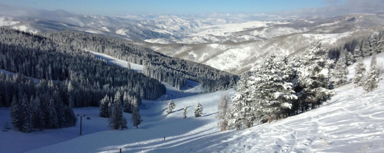
Vail is high in the mountains, and therefore experiences pleasantly warm summers and cold winters. The temperature rarely rises above freezing from Thanksgiving to late February. The town of Vail receives an average of 200 inches of snowfall per season, with even more in the surrounding mountains. Roads may occasionally close. In summer, the thermometer can reach the 80s, but more often hovers around the low to mid-70s. Combined with brisk mountain breezes, this makes summers refreshing and cool.
| Jan | Feb | Mar | Apr | May | Jun | Jul | Aug | Sep | Oct | Nov | Dec | ||
| Avg. High | 31 | 34 | 39 | 46 | 56 | 67 | 73 | 71 | 64 | 54 | 39 | 32 | |
| Avg. Low | 0 | 3 | 11 | 18 | 27 | 34 | 39 | 38 | 31 | 22 | 11 | 3 | |
| Precipitation | 0.9 | 1.0 | 1.1 | 1.2 | 1.5 | 1.2 | 1.8 | 1.7 | 1.3 | 0.8 | 0.9 | 0.8 | |
Live weather is currently unavailable.
Please visit weather.gov for current and forecasted weather.
This Afternoon
Chance Snow Showers
Tonight
Scattered Snow Showers then Patchy Fog
Wednesday
Patchy Fog then Chance Snow Showers
Wednesday Night
Snow Showers
Thursday
Snow Showers
Thursday Night
Snow Showers
Detailed Forecast |
|
|---|---|
| This Afternoon | A chance of snow showers. Mostly cloudy, with a high near 34. Northwest wind 10 to 15 mph, with gusts as high as 35 mph. Chance of precipitation is 70%. New snow accumulation of 1 to 2 inches possible. |
| Tonight | Scattered snow showers before midnight, then patchy fog and isolated snow showers. Mostly cloudy, with a low around 18. West northwest wind 5 to 10 mph, with gusts as high as 30 mph. Chance of precipitation is 30%. New snow accumulation of less than half an inch possible. |
| Wednesday | Patchy fog before 9am, then a chance of snow showers. Partly sunny, with a high near 42. Northwest wind 0 to 5 mph. Chance of precipitation is 30%. New snow accumulation of less than half an inch possible. |
| Wednesday Night | A chance of snow showers before 11pm, then snow showers and patchy fog. Cloudy, with a low around 28. South wind 0 to 5 mph. Chance of precipitation is 80%. New snow accumulation of 1 to 2 inches possible. |
| Thursday | Snow showers. Cloudy, with a high near 42. Southwest wind 5 to 15 mph, with gusts as high as 40 mph. Chance of precipitation is 100%. New snow accumulation of 1 to 3 inches possible. |
| Thursday Night | Snow showers. Mostly cloudy, with a low around 17. Chance of precipitation is 80%. New snow accumulation of 1 to 3 inches possible. |
| Friday | Snow showers and patchy fog. Mostly cloudy, with a high near 35. Chance of precipitation is 80%. New snow accumulation of 1 to 3 inches possible. |
| Friday Night | A chance of snow showers before 11pm, then areas of fog. Mostly cloudy, with a low around 11. New snow accumulation of less than one inch possible. |
| Saturday | Areas of fog before 8am. Mostly sunny, with a high near 38. |
| Saturday Night | Mostly clear, with a low around 11. |
| Sunday | Sunny, with a high near 46. |
| Sunday Night | Mostly clear, with a low around 17. |
| Monday | Sunny, with a high near 51. |
| Monday Night | Partly cloudy, with a low around 20. |


